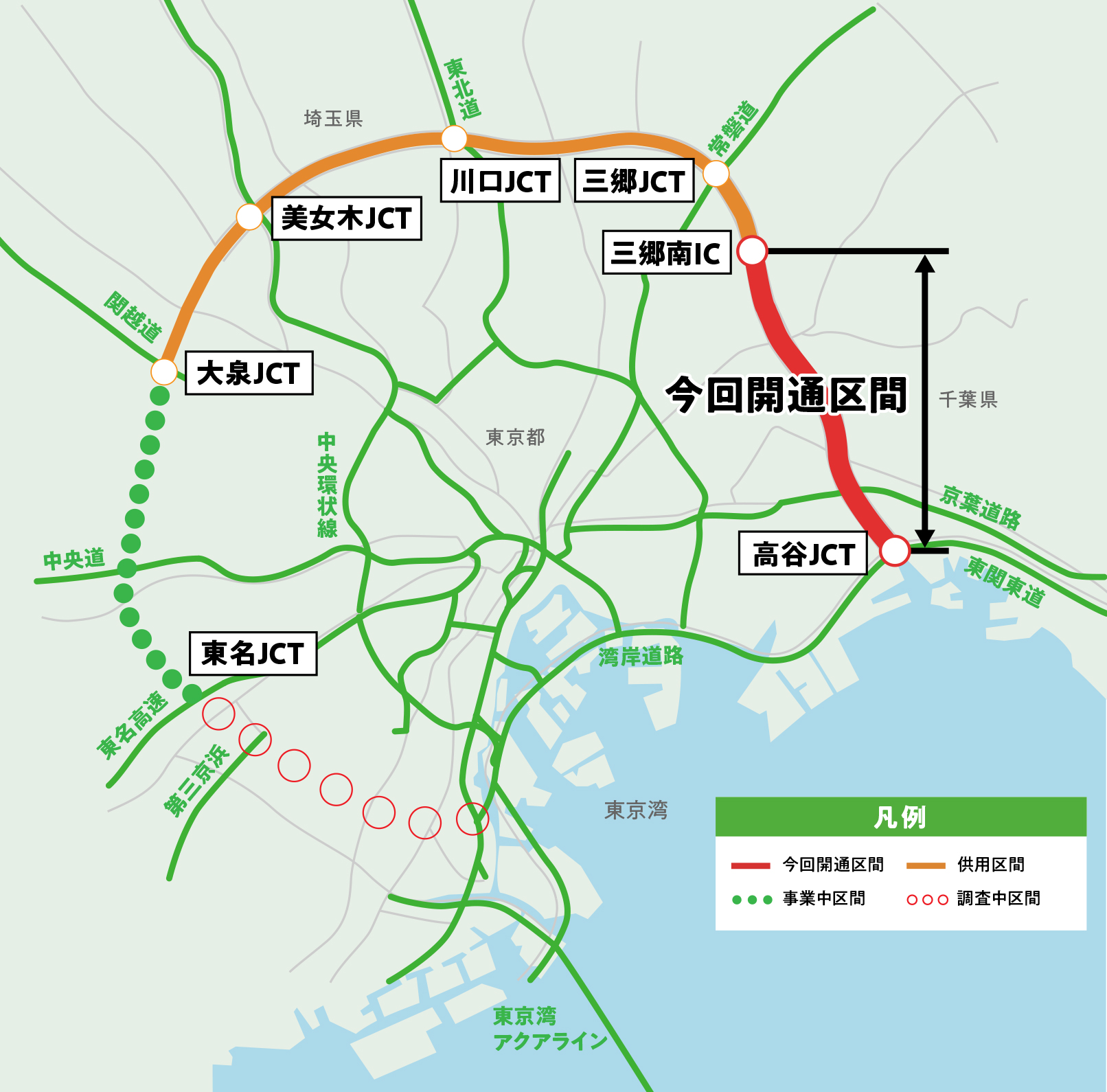
The Tokyo Outer Ring Road (commonly known as "outer ring") is an 85 km long trunk road that connects an area with a radius of about 15 km from the city center and is part of the 3-ring 9-radiant network. The purpose is to alleviate traffic congestion in the metropolitan area and realize a smooth transportation network between cities.
Alleviate traffic congestion in the metropolitan area,
A green road that creates a smooth road network
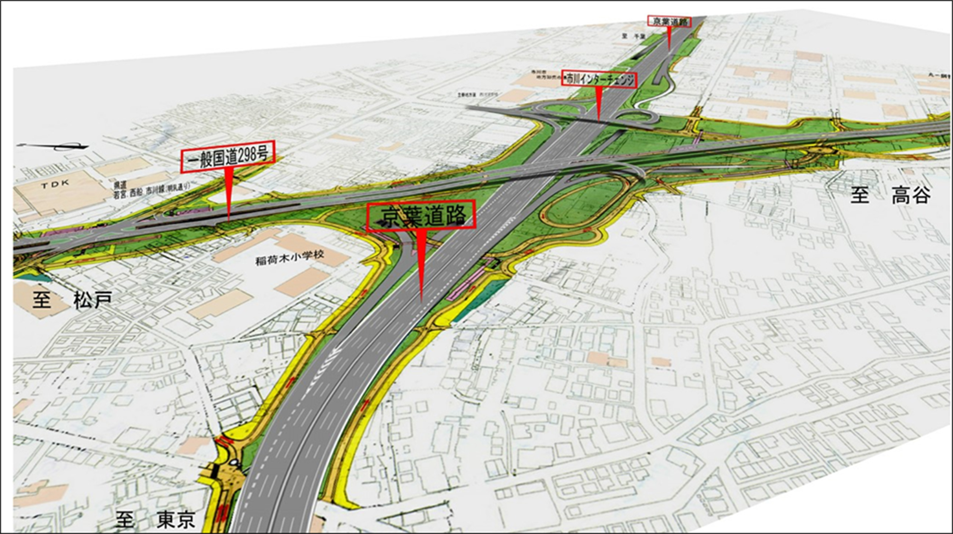
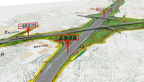
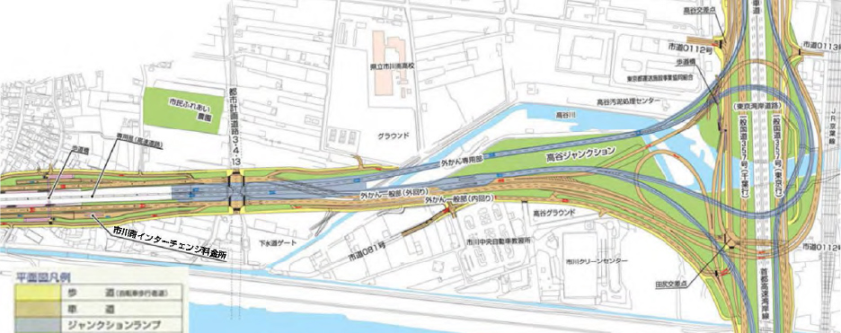
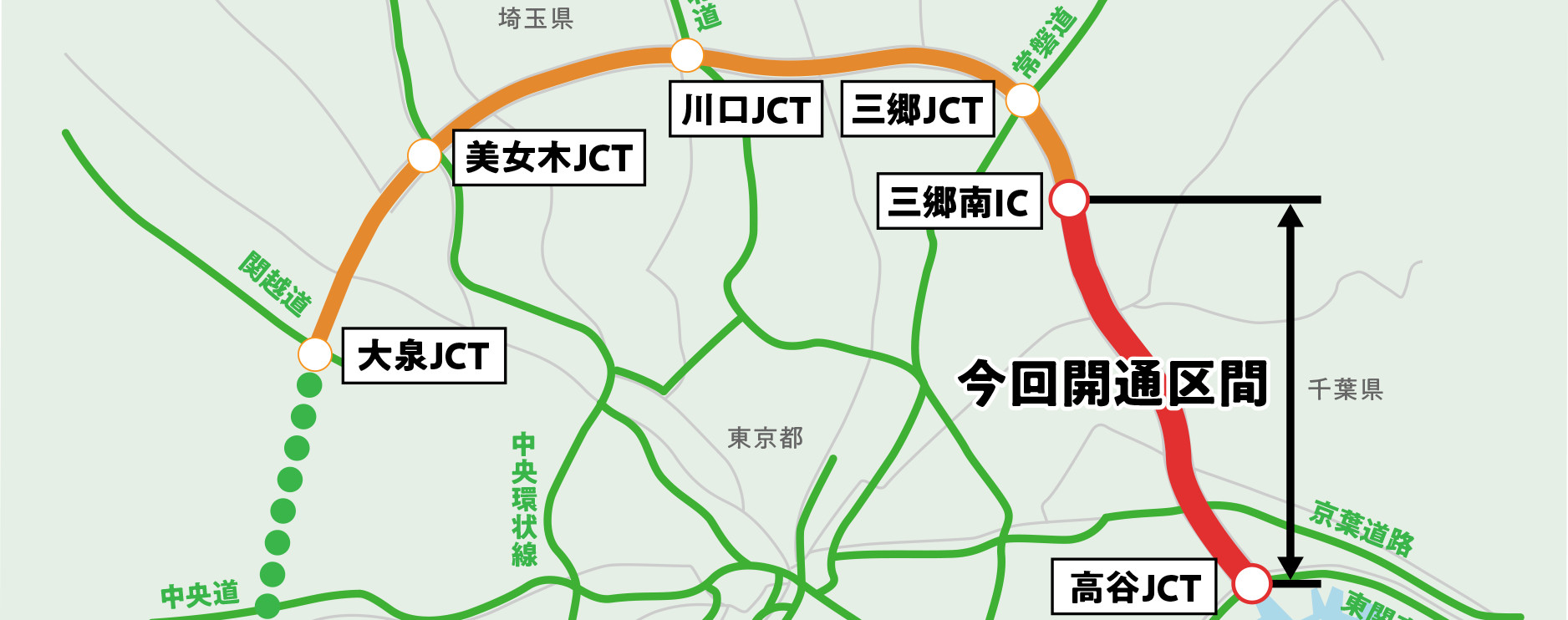
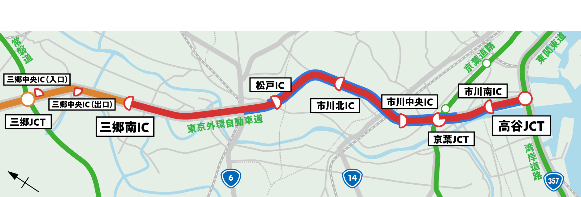
The “outer ring” plays a major role in alleviating congestion in the metropolitan area by connecting radiant roads extending from the center of the city to disperse traffic concentrated in the city center and bypassing transit traffic in the city. It is a road. Of this, the Misato-Takaya section that will be opened this time will be a section of approximately 15.5km from Misato City to Takaya, Ichikawa City. The area has few north-south access roads and chronic congestion.
In addition, “deterioration of traffic environment” is becoming a problem, as cars that try to avoid traffic jams enter the roads of daily life and increase accidents.
The “outer ring” is expected to play a central role in Misato City, Katsushika Ward, Matsudo City, and Ichikawa City to solve these problems.
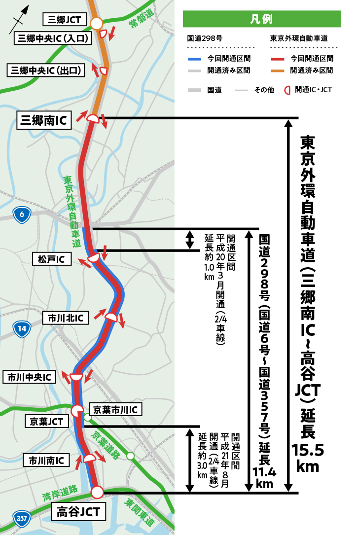


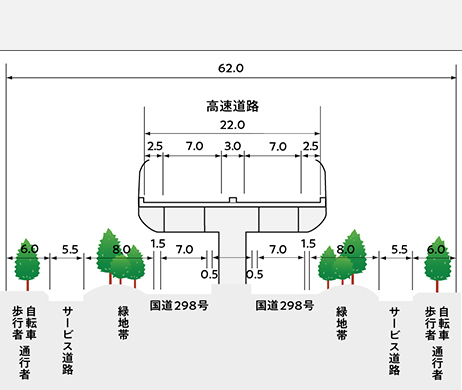
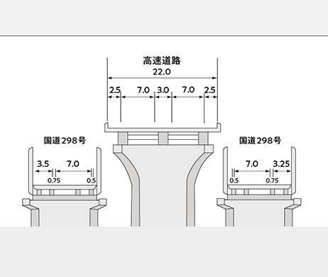
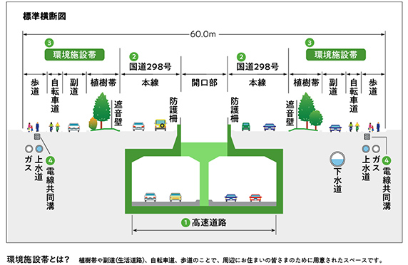
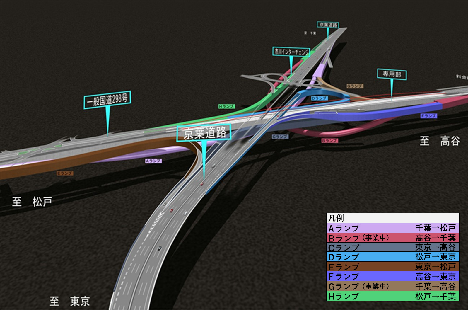
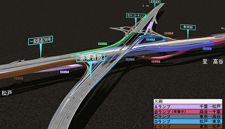
➊ Expressway
In addition to converting wide-area transit traffic from general roads, it will also be a high-speed means of transportation to other areas.
❷ National Highway Department (National Highway 298)
It is in close contact with the city streets, serves as a transportation axis in the north-south direction of the area, and can also be used as a bus route, which is the backbone of town development.
❸ Environmental facility zone
It consists of a bicycle path, sidewalks, a secondary road for automobile traffic in the area, and a tree-planting zone for separation from the national road section (main line).
➍ Underground storage space
It houses facilities that are indispensable for daily life, such as water and sewage, gas, electricity, and telephone.