災害時の緊急退避所を確保できるよう
沿道商業施設・自治体・道路管理者で協定を締結しました
- Corporate Top
- Press Room
- Press Release Kanto Regional Head Office
- Agreement concluded between roadside commercial facilities, local governments, and road administrators to secure emergency shelters in the event of a disaster
November 5, 2020
East Nippon Expressway Co., Ltd.
Kanto Regional Head Office Nagano Management Office
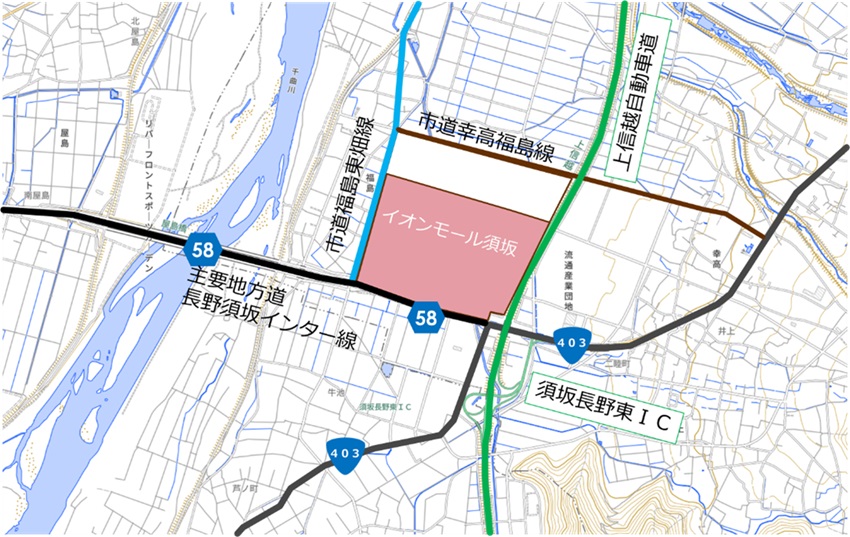
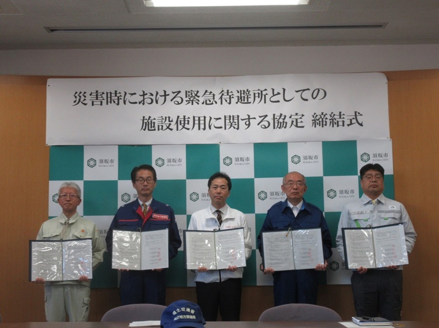
NEXCO EAST Nagano Management Office (Nagano City, Nagano Prefecture) signed an agreement on the use of facilities as emergency evacuation shelters in the event of a disaster with AEON Mall Suzaka, the Ministry of Land, Infrastructure, Transport and Tourism's Kanto Regional Development Bureau Nagano National Highway Office, Nagano Prefecture Suzaka Construction Office, and Suzaka City on Thursday, October 30, 2025.
1. Purpose and expected effects of the agreement
AEON Mall Suzaka is located close to the Suzaka Nagano East Interchange on Joshin-Etsu Expressway. In the event of a disaster or the risk of a disaster, road users on national, prefectural, and Expressway can use the parking lot of AEON Mall Suzaka as an emergency evacuation shelter. For example, during heavy snowfall, when national and Expressway are simultaneously closed due to stranded vehicles or accidents, it is expected that vehicles will become stranded. In such an event, it is expected that the parking lot will be used as an evacuation shelter for stranded vehicles.
When vehicles become stranded, traffic congestion occurs on surrounding roads, which not only affects the lives of local residents but also may affect the response to traffic accidents and the passage of disaster recovery vehicles.
In addition, if heavy snowfall of a warning level is expected, national highways and Expressway may be closed simultaneously as a preventative measure (closing roads in advance). In such cases, it is expected that these areas will also be used as evacuation shelters.
2. Positional relationship
3. The signing ceremony

To view the PDF file, you need the Adobe Systems plug-in software "Acrobat Reader (Japanese version)". If you do not have Download from here (free)Please use it.
Related Sites and Content
If you are looking for information on fares, routes, service areas and parking areas, please click here.
If you are looking for real-time traffic congestion and restriction information, click here.
NEXCO EAST (Road Disaster Prevention Information) Official X
Click here if you are looking for road information such as road closures during disasters.