
- Installation location
[E50] Regarding the expected opening date and name decision for the "(tentative name) Shimotsuke Smart Interchange" Kita-Kanto Expressway
- Corporate Top
- Press Room
- Press Release Kanto Regional Head Office
- [E50] Regarding the expected opening date and name decision for the "(tentative name) Shimotsuke Smart Interchange" Kita-Kanto Expressway
May 29, 2020
Shimotsuke City
East Nippon Expressway Co., Ltd., Kanto Regional Head Office
Regional Head Office would like to inform you that, based on the current progress of construction, we have decided on the expected opening date and name for the smart interchange (hereinafter referred to as "Smart IC") that connects to the E50 Kita-Kanto East Nippon Expressway Co., Ltd., which has been under construction by Shimotsuke City, Tochigi Prefecture and the Kanto Branch Kita-Kanto Expressway Saitama City, Saitama Prefecture).
1. Opening date forecast
Winter 2026
- If the procurement of materials and equipment proceeds smoothly
2. Names of smart ICs
Decision name
"Shimotsuke Smart Interchange"
3. Overview of smart ICs
position:
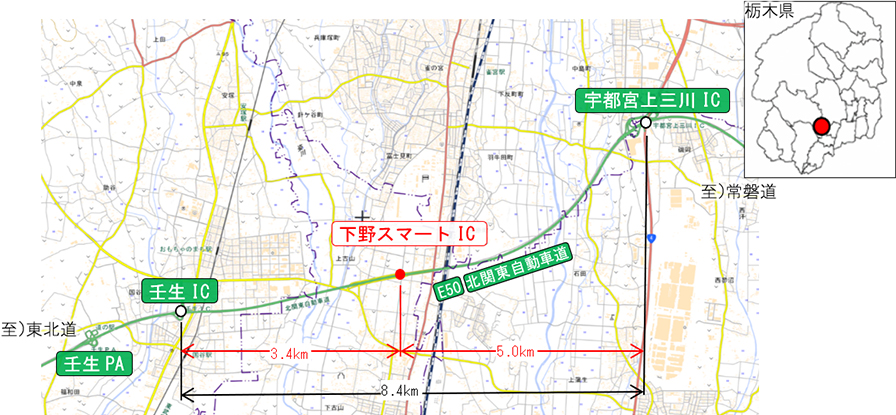
Connects to the main line of the Kita-Kanto Kita-Kanto Expressway Mibu IC to Utsunomiya-Kaminokawa IC.
location:
Shimokoyama and Kamikoyama, Shimotsuke City, Tochigi Prefecture
- Operating hours
Available 24 hours
- Usage form
Once stopped
- Target vehicle type
All models equipped with ETC in-vehicle device
Four. Other
- For information on the expected maintenance effects, please refer to the attached document [PDF: 914KB].
Concept of name
To ensure that users of the smart interchange can clearly identify it as an ETC-only smart interchange and an entrance/exit connecting to Shimotsuke City, the name "Shimotsuke Smart Interchange" was chosen, incorporating the name of the local government, "Shimotsuke."
Background to the name decision
This name was decided upon after consideration by the "(Provisional Name) Shimotsuke Smart Interchange Area Council," which is composed of Shimotsuke City and other entities, and based on a proposed name that took into account the opinions of the Road Signage Improvement Committee, which is composed of road administrators in Tochigi Prefecture, and was officially decided upon by the Japan Expressway Holding and Debt Repayment Agency through the prescribed procedures.
Location map
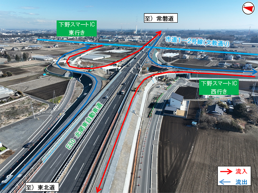
Current situation (aerial view)

To view the PDF file, you need the Adobe Systems plug-in software "Acrobat Reader (Japanese version)". If you do not have Download from here (free)Please use it.
Related Sites and Content
If you are looking for information on fares, routes, service areas and parking areas, please click here.
If you are looking for real-time traffic congestion and restriction information, click here.
NEXCO EAST (Road Disaster Prevention Information) Official X
Click here if you are looking for road information such as road closures during disasters.