Responding to heavy snowfall and climate change
- Corporate Top
- Sustainability
- Contribution to the local community
- Resilient Expressway
- Responding to heavy snowfall and climate change
- Resilient Expressway Page
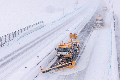
Preparing for heavy snow
NEXCO EAST Group is characterized by its widespread coverage of snowy regions. With the working-age population declining, securing new workers is a challenge. In addition, driving and operating snowplows requires a certain level of driving skill and experience, but we are working to develop technology that will enable even those with little experience to operate snowplows reliably in the future.
Development status of Advanced Snow and Ice Countermeasure System (ASNOS)
Automating rotary snowplows using quasi-zenith satellites
Accurate position information based on a driver assistance system (guidance monitor) using quasi-zenith satellites is linked to the rotary snowplow's operation control device, automating the snowplow's driving and operation. This allows the operator to accurately drive and remove snow without touching the steering wheel or levers, improving the safety and efficiency of snow removal work to ensure road traffic in winter. The system will begin operation in fiscal 2023 on the Do-o Expressway between Iwamizawa IC and Bibai IC.

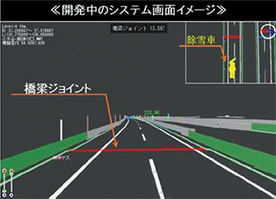
Snow removal truck operation support system
We are developing a system that utilizes high-precision positioning signals from quasi-zenith satellites and high-precision maps to assist operators in their work operations, equipped with a guidance monitor that displays the snow removal truck's position and the distance to the bridge joint.
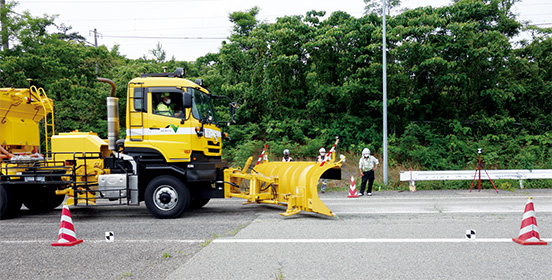
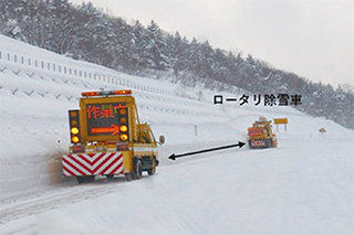
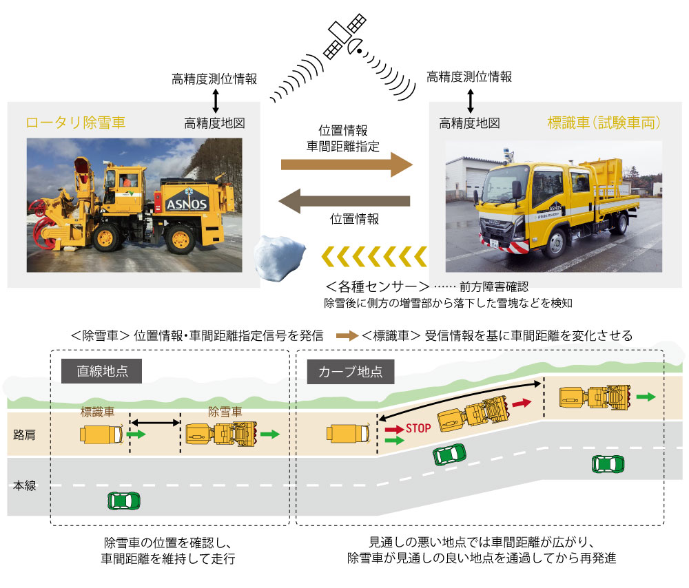
Development of a beacon vehicle that automatically follows a snowplow
We are working with Isuzu Motors to develop technology that will enable a warning vehicle to automatically follow a rotary snowplow, warning drivers to prevent collisions and rear-end collisions with rotary snowplows operating at low speeds. Vehicle development began in fiscal 2021, and performance was verified through road tests on main Expressway in the summer and winter of fiscal 2024. Going forward, we will continue to study the technology for practical use, aiming to reduce labor and improve efficiency by further improving the accuracy of this technology.
TOPIC
Putting human life first and minimizing the impact of heavy snow - Safety measures for snowy roads
Snow removal distance: 690,000 km (approximately 17 times around the Earth)
Our group has many areas with severe winter weather conditions. Therefore, snow removal and preventing road surface ice are important missions to ensure safe driving for our customers. In fiscal year 2024, there was more snowfall than usual in various areas, including record-breaking snowfall in Obihiro, Hokkaido in early February and snowfall across the greater Tokyo area in early March. However, based on past experience (a maximum of over 2,000 vehicles stranded due to heavy snowfall), we made human life our top priority and made it through the winter. For example, we implemented preventive road closures to thoroughly avoid vehicle strandings.
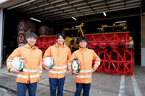
Click here to hear from employees who clean Expressway roads
Isuzu Town (Provided by Isuzu Motors Ltd.)
A job that maintains the "safety, security, comfort, and convenience" of Expressway 24 hours a day, 365 days a year
(NEXCO Maintenance Niigata Co., Ltd.) https://www.isuzu.co.jp/town/hiroba/people/04/
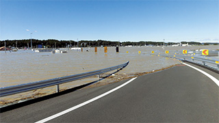
Countermeasures against disasters caused by climate change
We are taking measures such as raising road levels to prevent major damage to Expressway facilities from flooding (continuous rainfall caused by linear rain bands, sudden heavy rain, overflowing or flooding of nearby rivers, water flowing from outside Expressway, etc.) We are also working to incorporate adaptation measures into the "NEXCO EAST Group Carbon Neutral Promotion Strategy," which takes into account the unavoidable nature of climate change.
Initiatives to adapt to climate change - Adaptation measures
We will promote adaptation measures to deal with floods and extreme weather events, which are becoming more frequent and severe due to the effects of global warming.
| Hard side | Building strong and reliable Expressway | Building a robust and reliable Expressway based on new standards that can be used safely and securely even during extreme weather |
|---|---|---|
| Soft side | Technical standards and information system measures in preparation for disasters | Review technical standards and guidelines based on recent meteorological data and technical knowledge, and consider introducing systems that utilize information and communications technology. |
| Strengthening disaster response capabilities | Strengthening response capabilities through joint training in preparation for disasters in cooperation with the national and local governments and the Self-Defense Forces. |
Hardware measures
Building strong and reliable Expressway
Maintaining the functionality of critical infrastructure
大雪や大雨によって車両の立ち往生やのり面崩壊等が発生した際、4車線のうち2車線で交通規制を確保することや、並行する一般道が通行止めになった際の代替路として機能する4車線化事業に取り組んでいます。
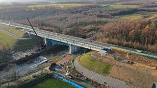
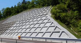
We are also working to strengthen disaster resistance by reinforcing slopes based on important infrastructure functions, strengthening drainage functions, and taking measures to prevent soil and sand from entering the area from outside.
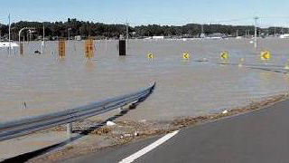
Responding to flood damage
At interchanges and other locations where large-scale flooding due to heavy rain or other factors is expected to occur or be affected, measures to prevent flood damage are being implemented by raising the road surface.
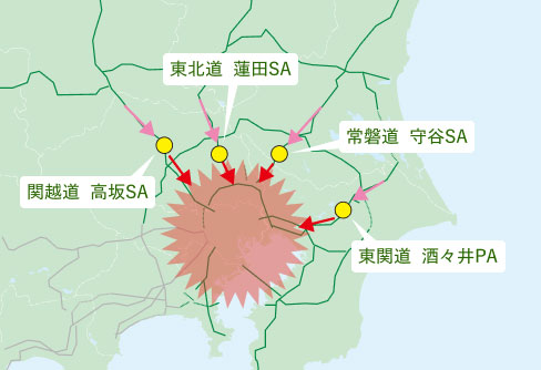
Development of areas equipped with disaster prevention functions
In the event of a major earthquake, tsunami, or other disaster, Expressway bases (advancement points) for the Self-Defense Forces, fire departments, police, and other related organizations to support rescue and recovery efforts in the affected areas.
In preparation for power outages during disasters, we are working to install private generators and wells at major rest facilities. In addition, we are establishing "disaster prevention function base areas" equipped with heliports, disaster prevention warehouses, etc. at rest facilities near cities.
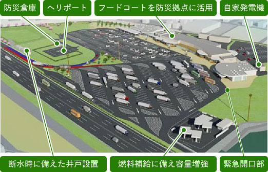
Development of disaster prevention function base areas
Strengthening the response capabilities of disaster response centers
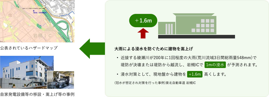
At local offices and other facilities that serve as response bases in the event of a disaster, we are taking measures such as relocating or raising important facilities (power receiving and distribution facilities, private power generation facilities, etc.) to prepare for flood damage caused by river flooding or excessive water levels, and are working to strengthen our response capabilities in the event of a disaster.
Soft measures
Consideration of technical standards and information systems in preparation for disasters
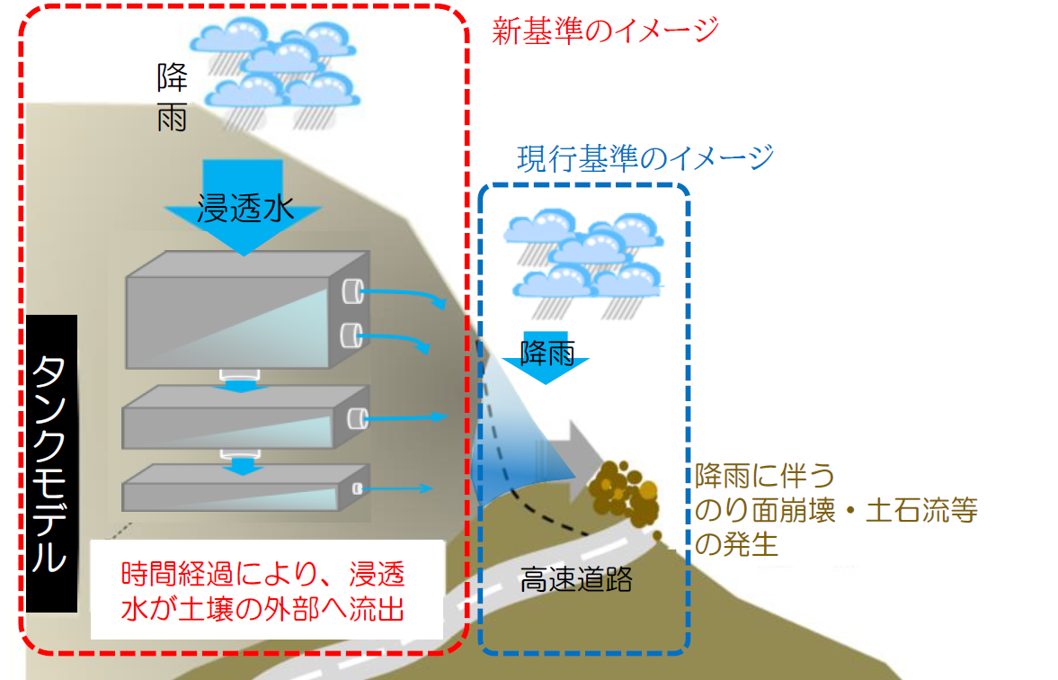
Transition to new standards for road closures during heavy rain based on scientific data
Regarding the criteria for road closures due to heavy rain, we will transition to new criteria (such as soil rainfall index) that take into account the amount of moisture in the soil based on scientific data*25, and aim to optimize the timing of starting and ending road closures by accurately detecting the occurrence of disasters.
- 25 The current standard uses the "continuous rainfall method" or "combination of continuous rainfall and hourly rainfall" based on rainfall experience.
Providing real-time information during disasters
In the event of disaster-level abnormal weather such as heavy rain, typhoons, or heavy snow, we aim to minimize the social impact by providing information on sections that may be closed, and publicizing advice on refraining from travel and caution via our website and social media, thereby supporting decisions on logistics operations and travel.In addition, in the event of heavy snow, we will prioritize human life and thoroughly eliminate large-scale vehicle backlogs on major roads by cooperating with relevant organizations such as the national and local governments to implement preventive road closures.
Strengthening disaster response capabilities
Collaborative efforts with related organizations
In recent years, there have been frequent occurrences of torrential rains, including sudden downpours, which have resulted in disasters such as river flooding and landslides in various areas. For this reason, we will work with related organizations to strengthen our disaster response capabilities by conducting joint disaster prevention drills, and we will also work on responding to emergency evacuations using Expressway in the event of flooding caused by river overflows.
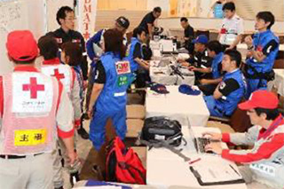
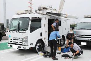
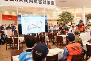
Examples of joint disaster prevention drills conducted in cooperation with the Self-Defense Forces and other related organizations
Strengthening response capabilities using disaster prevention drones
When a disaster occurs, it is necessary to quickly grasp the situation on the ground, but this can be extremely difficult due to factors such as the location of the disaster site in a mountainous area, the risk of secondary disasters due to re-flow of landslides, and the widespread scale of the disaster. In such disaster sites, we will work to strengthen our disaster response capabilities by utilizing new technologies and equipment, such as collecting accurate information using "disaster prevention drones" that can grasp the situation on the ground in detail through real-time footage from the sky.
| Overview | Shooting image | |
|---|---|---|
| [February 2021] Kita Kanto Expressway Ashikaga City forest fire Monitoring the spread of fire |
In a forest fire that broke out in Ashikaga City, the fire spread to part of the slope of the Kita-Kanto Expressway, so an infrared camera mounted on a drone was used to grasp (monitor) the extent of the fire, which cannot be seen with the naked eye. |
![[February 2021] Image of monitoring the spread of a forest fire in Ashikaga City, Northern Kanto Expressway](/assets/img/csr/community/resilient/climate_action/img_shooting_01.jpg)
|
| [July 2021] [illegible] Slope collapse due to rainfall Checking the accumulation and surrounding conditions |
A landslide occurred due to the influence of an active rainy season front centered on the Kanto region. To understand the local situation after the disaster and consider recovery plans, a 3D model created from aerial photographs was used to calculate the amount of sediment [runoff/accumulation]. |
![[July 2021] Image of slope collapse and sedimentation caused by rainfall and surrounding conditions](/assets/img/csr/community/resilient/climate_action/img_shooting_02.jpg)
|